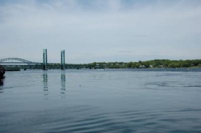
Piscataqua River Fishing Spot
- Elevation: 76'
- Last Modified By: overstdr on 09/03/09 11:03 PM
- Ask about Piscataqua River in our Fishing Forums
Photos
Comments
-
Have you fished at Piscataqua River? Be the first to comment on this fishing spot.
Piscataqua River Description
The Piscataqua River, in the northeastern United States, is a 12-mile (19 km) long tidal estuary formed by the confluence of the Salmon Falls and Cochecho rivers. The drainage basin of the river is approximately 1,495 square miles (3,870 km2). The river runs southeastward, determining part of the boundary between the states of New Hampshire and Maine, and empties into the Atlantic Ocean east of Portsmouth, New Hampshire. The last six miles before the sea form one of the finest harbors in the northeastern United States, despite a tidal current rated as one of the fastest in North America (at Nobles Island across from downtown Portsmouth).[1]