Ellis River Fishing Spot
- County: carroll county
- Public Fishing: Yes
- Elevation: 3585'
- Shoreline: 17'
- Website: http://en.wikipedia.org/wiki/Ellis_River_(New_Hampshire)
- Last Modified By: carpmaster on 03/27/09 08:41 PM
- Ask about Ellis River in our Fishing Forums
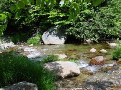
Photos
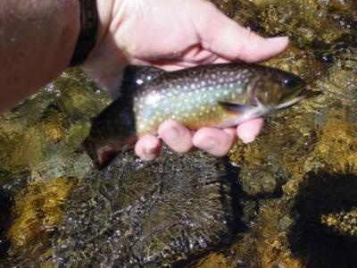
Fish Species
Ellis River Description
The Ellis River is a 16.7 mile long (26.9 km) river in the White Mountains of New Hampshire in the United States. It is a tributary of the Saco River, which flows to the Atlantic Ocean in Maine. Sometimes it’s just hard to choose a trail to ski at a cross-country ski center. That can happen in Jackson, New Hampshire. When it does, try this long loop, which features three of the system’s trails—Ellis River, High Water, and the Hall. The Ellis River Trail is a favorite among White Mountain trails. The trail runs through evergreens and hardwoods. The Ellis River rises on the eastern slopes of Mount Washington, the highest peak in the northeastern United States. Flowing south, it is quickly joined by the Cutler River flowing out of Tuckerman and Huntington ravines, passes over Crystal Cascade, and reaches the floor of Pinkham Notch. The river leaves the level ground at the high point of the notch by dropping over Glen Ellis Falls, then continues south into the town of Jackson, New Hampshire, through a gradually widening valley. Leaving the small intervale at Jackson village, the Ellis River drops over a hydroelectric dam at Goodrich Falls and reaches the Saco River near the village of Glen in the town of Bartlett. New Hampshire Route 16 follows the Ellis River from the height of land in Pinkham Notch south to Glen.
Coordinates: 44°06?16?N 71°10?20?W? / ?44.1045°N 71.1723°W? / 44.1045; -71.1723