Dead Diamond River Fishing Spot
- County: coos county
- Elevation: 1458'
- Last Modified By: salientwolf on 03/27/09 08:18 PM
- Ask about Dead Diamond River in our Fishing Forums
Photos
Fish Species
Comments
-
Have you fished at Dead Diamond River? Be the first to comment on this fishing spot.
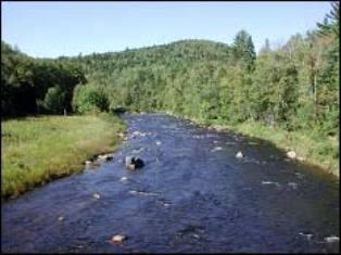
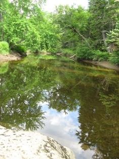
Dead Diamond River Description
The Dead Diamond River is an 18.7 mile long (30.2 km) river in northern New Hampshire in the United States. Its water enters the Atlantic Ocean on the coast of Maine by passing through the Magalloway, Androscoggin, and Kennebec rivers.
The Dead Diamond River is formed in the township of Atkinson and Gilmanton Academy Grant, New Hampshire by the juncture of the Middle Branch and the East Branch of the Dead Diamond. It is quickly joined by the West Branch of the Dead Diamond and heads south through logging country. The Little Dead Diamond River joins from the west at Hell Gate, a set of rapids, just before the Dead Diamond enters the Dartmouth College Grant. The river traverses the length of the college grant before reaching the Magalloway River near the Maine border. The Swift Diamond River is a significant tributary which joins the Dead Diamond shortly upstream of the Magalloway.
Coordinates: 44°58?31?N 71°07?23?W? / ?44.9753°N 71.1231°W? / 44.9753; -71.1231 The Little Dead Diamond River is a 7.1 mile long (11.4 km)[1]river in northern New Hampshire in the United States. It is a tributary of the Dead Diamond River, located in the Androscoggin River watershed of Maine and New Hampshire.