Ammonoosuc River Fishing Spot
- County: Grafton County
- Public Fishing: Yes
- Elevation: 483'
- Shoreline: 70'
- Website: http://en.wikipedia.org/wiki/Ammonoosuc_River
- Last Modified By: carpmaster on 06/23/13 09:04 PM
- Ask about Ammonoosuc River in our Fishing Forums
Photos
Fish Species
Comments
-
Have you fished at Ammonoosuc River? Be the first to comment on this fishing spot.
Ammonoosuc River Description
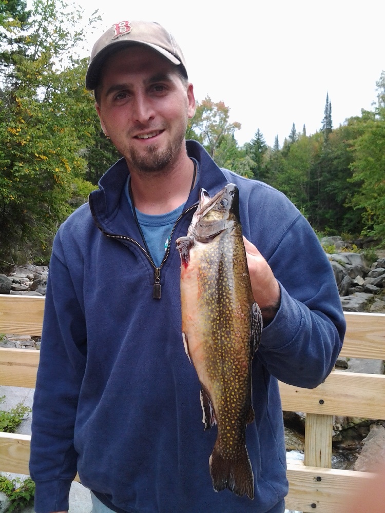
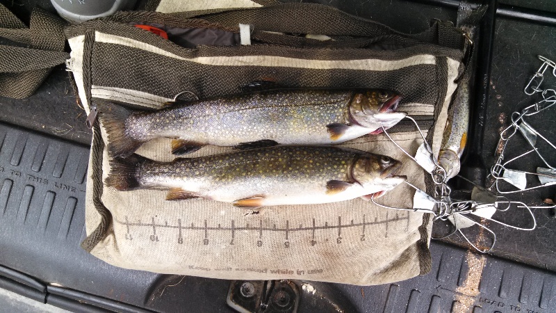
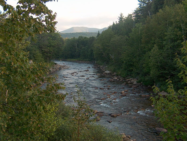
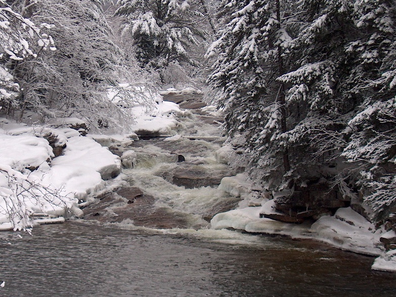
The Ammonoosuc River originates at Lakes of the Clouds on Mt. Washington in the heart of the White Mountain National Forest, then flows west for 55 miles before entering the Connecticut River in Haverhill, NH. The river is managed for it's Brook Trout and is heavily stocked by the state. The upper Ammonoosuc River above Bethlehem is a fast-moving river that runs cool even in the summer. There is easy access from Rt. 302 which parallels the river. This section is the best for Brook Trout fishing. Fishing pressure is spotty.
The lower section of the Ammonoosuc, a series of long pools seperated by riffles, runs through farmland. There are 4 dams on this stretch. The best fishing here is from May through July. That is also the period of highest fishing pressure. There are many places to camp out or spend the night in this area.
The Wild Ammonoosuc, originating near Kinsman Notch in the White Mountain National Forest, is a typical, fast-flowing mountain stream. It runs 15 miles along Rt. 112 before joining the Ammonoosuc in Bath, NH. The upper 6 miles supply water for Woodsville, NH. The remainder of the river is heavily stocked. Fishing pressure is spread out over the river's length. For some reason, this river is not heavily fished by tourists. The best fishing here is from the season opening through June. Both streams are stocked with Atlantic Salmon fry as part of the Connecticut River Atlantic Salmon Restoration Program.
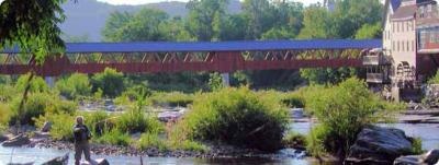
The Ammonoosuc River is a river, 55 mi (89 km) long, in northwestern New Hampshire in the United States. It is a tributary of the Connecticut River, which flows to Long Island Sound. Due to its largely undeveloped landscape, proximity to the White Mountain National Forest and highly diverse natural communities the Ammonoosuc River boasts a large variety of wildlife and plant species. Several recreation areas along the Ammonoosuc River allow for a variety of recreational opportunities along the river, include fishing, boating, and land-based activities. The Ammonoosuc River is a high quality fishery for both cold and warm water species and according to N.H. Fish and Game Department the river is suitable for wild, self-sustaining populations of brook trout. The Ammonoosuc River is stocked annually with Atlantic salmon, rainbow, brook and brown trout. Public access for fishing, kayaking, canoeing, and swimming can be found almost anyplace along the Ammonoosuc where there isn’t a private residence. Publicly owned recreation areas include the White Mountain National Forest Zealand Mountain trails in Carroll, the town park in Lisbon, Dells Park in Littleton, the Bath Covered Bridge Picnic Area, and many state and federal snowmobile trails in every town. These areas offer a mix of recreational opportunities including hiking, nature study, picnicking, swimming, river access, recreational fields and snowmobile trails. The Ammonoosuc rises on the western slope of Mount Washington, in Sargent's Purchase in the White Mountains of southern Coos County. One branch of the river is the outlet of the Lakes of the Clouds in the saddle between Mount Washington and Mount Monroe. Leaving the vicinity of the Presidential Range, the river flows westwardly into Grafton County, where it turns southwestwardly. Along its course the Ammonoosuc passes through Chandler's Purchase, Bean's Grant, and Crawford's Purchase; and the towns of Carroll, Bethlehem, Littleton, Lisbon, Landaff, Bath, and Haverhill to the village of Woodsville, where it flows into the Connecticut River. State Route 302 right of way extends to the river’s edge along many portions of the river. There are several informal pull offs along the river which make it easily accessible to the public for recreation. There are also several private campgrounds along the river that provide access to registered campers.
The Ammonoosuc River is a river, 55 mi (89 km) long, in northwestern New Hampshire in the United States.[1][2] It is a tributary of the Connecticut River, which flows to Long Island Sound. "Ammonoosuc" is Abnaki for "small, narrow fishing place". [3]